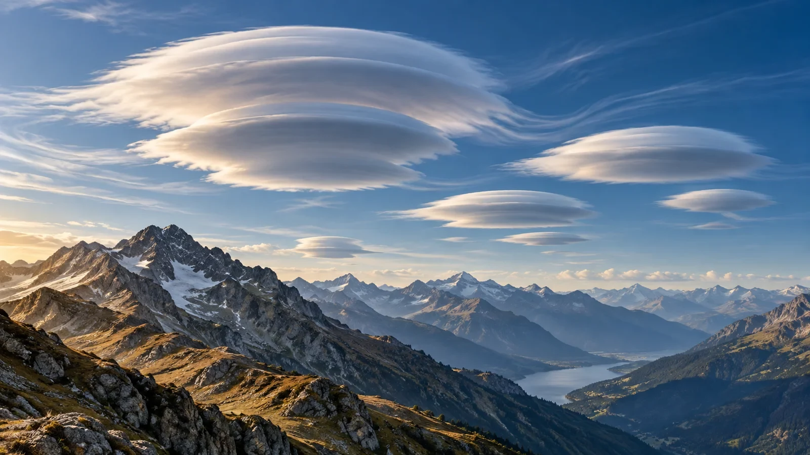
Lenticular clouds stand out because of their smooth, elongated and sometimes stacked shape, often compared with a lens or saucer. Their unusual appearance has a well-understood atmospheric cause: air crossing a mountain range can oscillate in waves, with cloud forming where the air rises, cools and becomes saturated.
The World Meteorological Organization classifies lenticularis as a cloud species with usually well-defined outlines, most often found in formations of orographic origin. The term applies mainly to cirrocumulus, altocumulus and stratocumulus. The best-known example is Altocumulus lenticularis.
How a lenticular cloud forms
When a relatively stable airflow meets a mountain, it is forced upwards on the windward side. After crossing the ridge, the air may descend and rise again, producing a sequence of atmospheric waves downstream. The comparison with ripples over an obstacle is useful, although the detailed physics is different.
If a layer contains enough moisture, cooling during the upward part of the wave produces condensation. On the downward side the air warms and the droplets evaporate. The visible cloud is therefore continuously created at one edge and removed at the other.
Why it seems stationary
A lenticular cloud can remain almost fixed for a long time while air flows rapidly through it. It is not always made of the same droplets: new droplets form in rising air and others evaporate in sinking air. The visible position belongs to the wave rather than to a motionless parcel of air.
This also helps produce the cloud’s polished edges. When several moist layers lie at different heights, multiple lenses may appear one above another.
Where lenticular clouds occur
They are common near mountain ranges and isolated peaks when the flow crosses the terrain with a substantial perpendicular component. They may form above a ridge or some distance downwind, so a cloud does not need to sit directly over the mountain to have an orographic origin.
The WMO also notes that lenticularis can occur where marked terrain is absent. Shape is therefore a strong clue, but the wider atmospheric setting and cloud level still matter.
What they say about the wind
A lenticular cloud is visible evidence of wave motion and of sufficient moisture at the level where it forms. In mountains it often accompanies cross-barrier flow and may show that winds aloft are stronger than conditions felt in a sheltered valley.
Mountain waves can be associated with rapid changes in speed and direction, strong vertical motion and turbulence. Rotors may also develop beneath the wave on the lee side. A photograph alone, however, cannot provide the exact wind speed, the altitude of turbulence or its severity.
What a lenticular cloud does not prove
- It does not by itself forecast a thunderstorm.
- It does not necessarily mean rain will reach the observer.
- It is not a reliable tornado signal.
- It cannot determine surface wind without other observations.
- A dramatic appearance does not automatically mean dangerous weather for everyone.
It may coexist with calm-looking skies while still being important for aviation or exposed mountain activities. Risk depends on the full picture: forecasts, warnings, observations, altitude, terrain orientation and wind evolution.
Guidance for mountain activities
If lenticular clouds appear before a high-level route, check the official forecast and current warnings. Compare summit wind with valley wind because the difference may be large. Blowing snow, ragged cloud, rapidly changing cover and difficulty walking on exposed ground are additional warning signs.
The cloud is not a substitute for a forecast and does not automatically require cancelling an activity. It is a reason to seek more information and reconsider safety margins, especially on ridges, passes and lee slopes.
How to recognise it
Look for a lens or almond shape, clear edges and several clouds aligned in a similar direction. Layers and iridescence are possible. Not every smooth isolated cloud is lenticular: convective clouds often change rapidly, whereas a lenticular cloud tends to preserve its position and outline for longer.
The principal technical reference is the WMO’s International Cloud Atlas. For safety decisions, always use current official forecasts and warnings rather than the appearance of the sky alone.