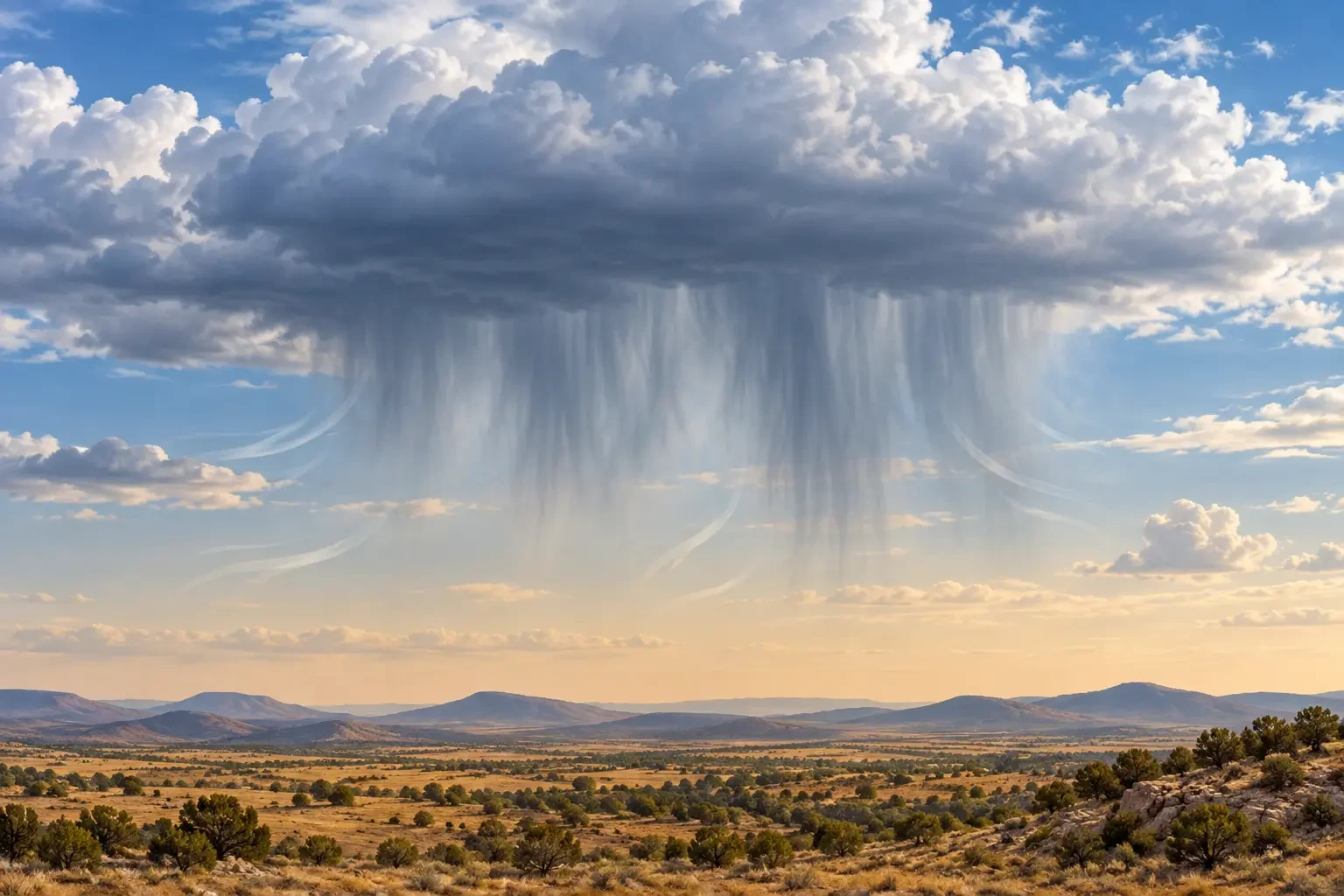
A cloud may appear to be producing rain, with grey streaks hanging from its base, while the ground remains dry. This phenomenon is called virga. The precipitation is real: it forms and falls from the cloud, but evaporates—or sublimates when made of ice crystals—before reaching the surface.
Virga is a visible clue to the atmosphere’s vertical structure. It shows that a sufficiently dry layer lies below the cloud, but it cannot by itself tell you how much rain will fall later or prove that severe weather is coming. This is an educational guide, not a current warning.
What virga means
The World Meteorological Organization’s International Cloud Atlas classifies virga as a supplementary feature: vertical or sloping precipitation trails attached to the underside of a cloud that do not reach the Earth’s surface. It can occur beneath altocumulus, altostratus, nimbostratus, stratocumulus, cumulus and cumulonimbus clouds.
From a distance it looks like a fibrous, fraying curtain that narrows and fades into the air. Wind can tilt the streaks and carry drops or crystals horizontally as they fall, so precipitation does not necessarily remain directly beneath the cloud that produced it.
Why precipitation disappears on the way down
A drop begins to evaporate when it enters unsaturated air. The drier that air is, and the longer the drop travels through it, the more water it loses. Small drops disappear faster than large ones. The depth of the dry layer, temperature, wind and cloud-base height also matter.
When precipitation begins as snow or ice crystals, it may change directly from solid to vapour through sublimation. Virga is therefore not limited to liquid summer rain; it can also occur in cold conditions.
How to tell virga from rain reaching the surface
- Virga: the streaks fade and end visibly above the horizon or terrain.
- Surface precipitation: the curtain usually appears more continuous down to the land, which may look darkened or obscured.
- Low cloud or fog: this occupies a broader, more uniform layer near the surface rather than hanging as fallstreaks.
Perspective can mislead. A curtain that seems to stop aloft may actually be raining far away. Surface observations, rain gauges or local reports are needed for confirmation.
Why radar and a rain gauge may disagree
Weather radar detects hydrometeors above the ground. It can therefore show precipitation echoes while a gauge below records zero because some or all of the drops have evaporated during descent. A radar colour also does not translate automatically into the amount collected at one location.
When water does reach the surface, accumulation is commonly reported in millimetres. Our guide to rainfall in millimetres explains the difference between total amount and intensity.
What virga may—and may not—say about wind
Evaporation cools the air around falling drops. This cooler, denser air can sink and, in some convective situations, contribute to gusts when it reaches the ground. However, seeing virga does not prove that a downburst will occur. Cloud depth, radar data, lightning, surface observations and official warnings provide the necessary context.
If virga hangs from a thunderstorm cloud, follow thunderstorm precautions even when your location is dry. Lightning can strike outside the visible rain curtain, and conditions may change quickly.
Virga, dry thunderstorms and light rain are different
Virga describes precipitation that disappears before reaching the surface. A “dry thunderstorm” generally means a lightning-producing storm with little or no measurable rain at the ground in a particular area. Such a storm may produce virga, but the terms are not interchangeable. Light rain is not necessarily virga either: if water is measured at the surface, precipitation has arrived there.
How to use this clue in a forecast
- Check whether the information comes from eyesight, radar or a rain gauge.
- Do not convert a radar echo into a surface rainfall total without ground data.
- Watch the trend: falling precipitation can moisten a dry layer, allowing later drops to reach the ground.
- With convection, lightning or sudden gusts, prioritise national weather-service warnings.
For Spain, current hazardous-weather information is published in the official AEMET warnings. Elsewhere, use the competent national weather service and civil-protection authority. Virga is a useful observation, not a replacement for an official forecast or alert.