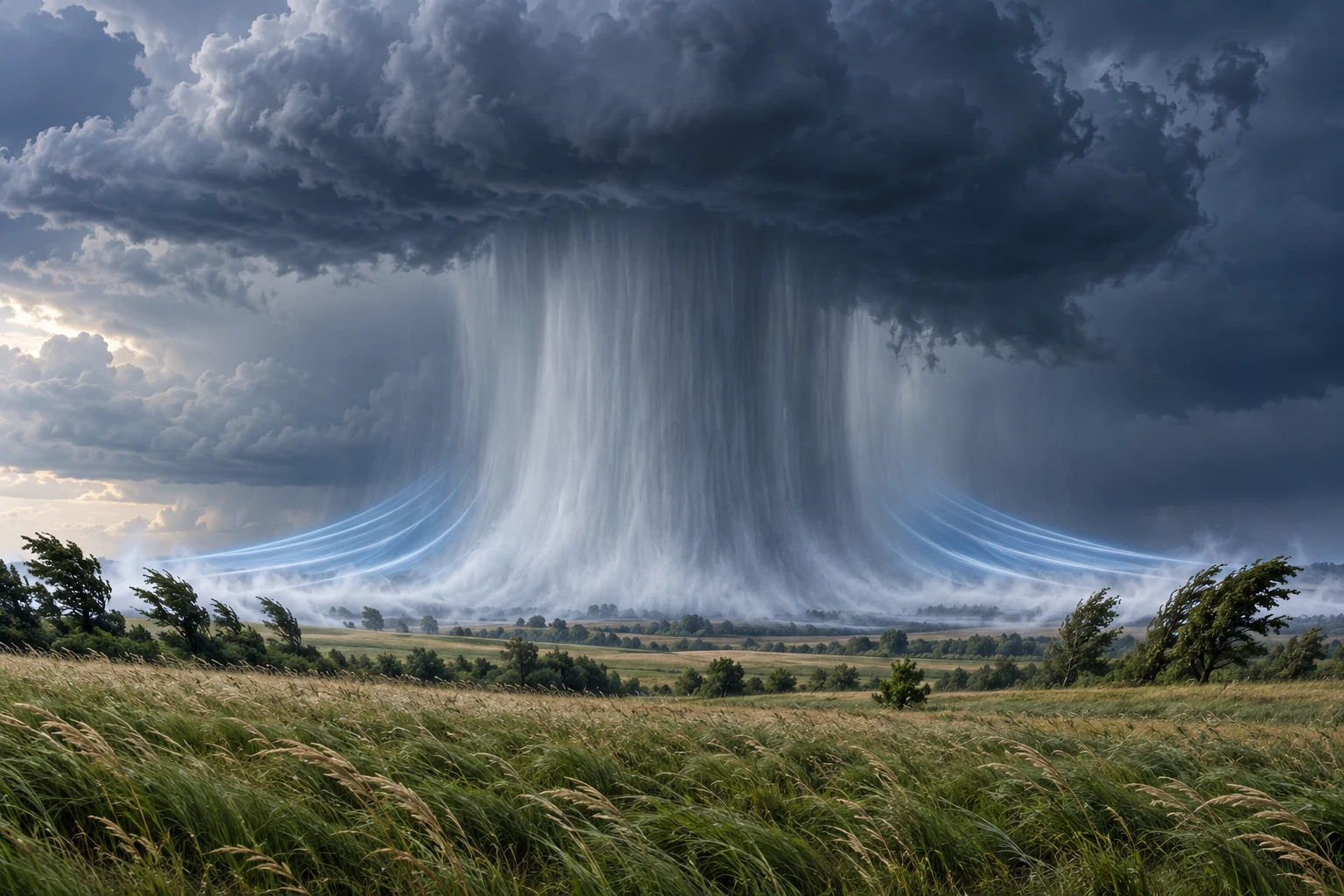
A thunderstorm does not need to produce a tornado to create dangerous winds. Air can descend rapidly from the cloud, strike the ground and spread horizontally. This is a downburst. The leading boundary of the cooler outflow may form a gust front, bringing a sudden change in wind speed and direction, sometimes before the rain arrives.
This is an educational safety guide, not a live warning. Before an outdoor activity, check current warnings from your national meteorological service. In Spain, use the official AEMET warning page.
How a downburst develops
Thunderstorms contain both rising and sinking air. Falling rain and ice drag air downward, while evaporation below the cloud cools the air and makes it denser. When a sufficiently strong downdraft reaches the ground, it cannot continue downward and spreads out, much like water striking a flat surface.
The result can be an abrupt, powerful wind from a rapidly changing direction. Downbursts are often short-lived and localised, yet they can break branches, move unsecured objects and make driving hazardous. A microburst is a particularly localised downburst; its small footprint does not imply weak winds.
What is a gust front?
A gust front is the boundary between relatively cool thunderstorm outflow and warmer surrounding air. It can move ahead of the rain shaft. Its passage may bring an immediate wind increase, a temperature drop and a shift in wind direction. Dust, leaves or loose debris may be lifted, although these signs are not always present.
Outflow can travel away from the parent storm. Blue or brighter sky overhead is therefore not a guarantee of safety when a dark line, advancing dust or nearby convection is visible.
Wet and dry downbursts
A wet downburst reaches the surface with substantial rain. In a dry downburst, much of the precipitation evaporates before reaching the ground. You may see virga—rain streaks beneath the cloud that fade in dry air. Evaporation can strengthen cooling and the descending flow.
Do not try to classify the event while it is happening. Heavy rain, virga and dust are clues, not proof, and none can tell you on its own how strong the next gust will be.
How is it different from a tornado?
A tornado is a rotating column of air associated with a convective cloud and in contact with the ground. In a downburst, air descends and spreads away from the impact area, so the prevailing pattern is divergent and more straight-line. Both can cause serious damage, and a dust cloud viewed from a distance can be misleading.
Specialists may use the damage pattern and observations to determine the cause afterwards. Members of the public should not attempt a diagnosis during the event: the safe response is to shelter from wind and flying debris.
Possible signs—and their limits
- rapid growth of a thunderstorm with a very dark base;
- a rain or hail shaft, or virga below the cloud;
- dust, leaves or debris advancing in a line;
- a sudden change in temperature, wind direction or wind strength;
- thunder becoming progressively closer.
These signs may appear late or remain hidden. Radar also has limitations for small, fast-evolving events. Do not wait for visual confirmation when an official warning is active or winds are already increasing. Our guide to estimating thunderstorm distance from lightning and thunder helps assess nearby electrical activity, but remember that outflow can arrive before rain.
What to do
At home or inside a building
- move into a substantial building and stay away from windows, glazed doors and exterior openings;
- secure pots, awnings, garden furniture and other loose objects before storms approach;
- do not go outside during the gust to retrieve belongings;
- when lightning is present, also follow our outdoor thunderstorm safety guidance.
Outdoors or near the coast
- leave beaches, breakwaters, small boats, ridges and exposed viewpoints;
- do not shelter beneath trees, light canopies, tents or temporary structures;
- seek an enclosed building or a hard-topped vehicle;
- keep away from branches, signs, scaffolding and power lines.
While driving
Reduce speed smoothly, increase following distance and hold the steering wheel firmly. Avoid sudden manoeuvres, especially when emerging from shelter or passing high-sided vehicles. If visibility or control becomes poor, stop in a legal, safe place away from trees, poles, watercourses and flood-prone ground. Never drive through water covering the road.
After the gust
Stay clear of fallen cables, damaged trees and unstable structures. Contact emergency services if there is immediate danger. Further storm cells may produce another burst, so a temporary lull does not necessarily mean the hazard has ended.
AEMET collects severe-weather observations through SINOBAS, whose phenomenon guides help explain events such as downbursts. Spain's Civil Protection service provides general self-protection advice for storms, heavy rain and wind. Always combine background guidance with current local warnings.
Key point
A downburst is descending thunderstorm air that spreads across the ground; a gust front is the leading edge of that outflow. Dangerous winds do not require a visible tornado. If wind rises abruptly, enter a solid shelter, stay away from glass and potential falling objects, and wait for official information before resuming your activity.