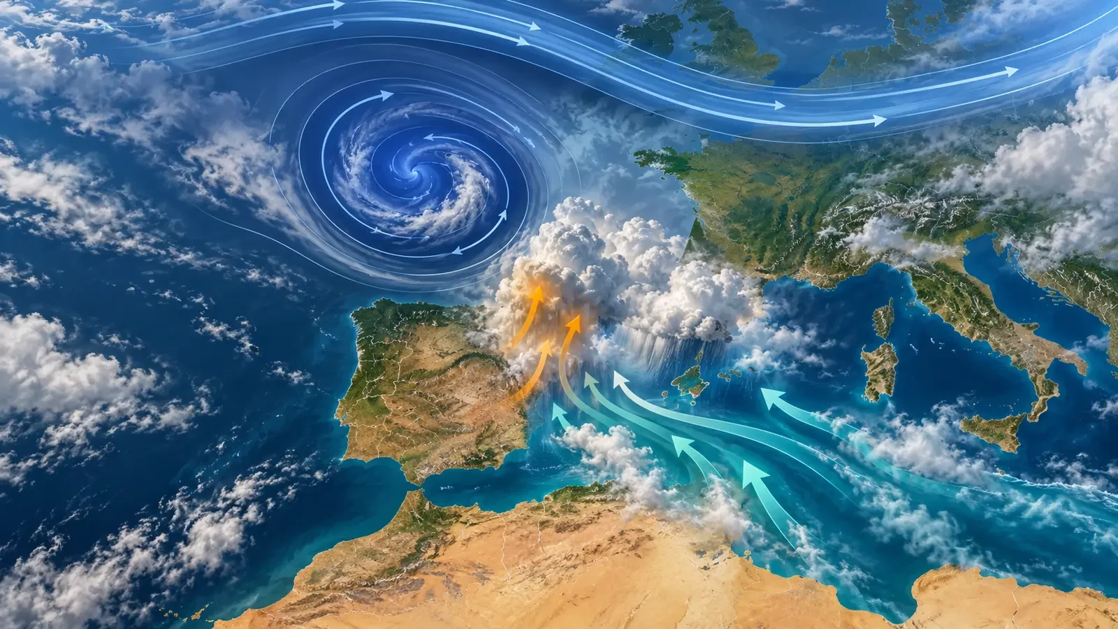
This is an educational guide, not a current weather warning. DANA is the Spanish acronym for an isolated depression at upper levels, broadly described in English as a cut-off low. It is a low-pressure circulation in the middle and upper troposphere that has detached from the main westerly flow. It describes an atmospheric structure, not a disaster. It can support severe thunderstorms and heavy rain when moisture, instability and lift overlap, but it can also pass without major impacts.
What exactly is a DANA or cut-off low?
Mid-latitude upper winds usually travel west to east in waves. One wave may deepen, narrow and eventually detach. A closed circulation of relatively cold air and low geopotential height is then left south of the main jet.
The diagnosis comes from upper-air charts, especially levels such as 500 hPa, not from surface rainfall totals. A thunderstorm, flooded street or radar image alone cannot prove that a DANA is present.
How it forms: from trough to isolated circulation
- The westerly flow develops a deep upper trough extending towards lower latitudes.
- The neck of the wave narrows until the circulation separates from the main flow.
- A closed upper low remains and may move slowly or follow a difficult-to-predict path.
Not every trough cuts off. Our guide to the upper-air trough explains the connected stage and the key distinction.
Why it does not guarantee torrential rain
Cold air aloft can increase the temperature contrast with warm, humid air below and make the atmosphere more unstable. Heavy rain still requires several ingredients to overlap:
- Enough moisture, often supplied by a warm sea but not exclusively.
- Lift from convergence, terrain, fronts or other forcing.
- Instability capable of sustaining deep updraughts.
- Persistence or repeated cells crossing the same area.
The low's position relative to moisture inflow and lifting zones matters more than the centre on one chart. With dry lower levels or weak lift, the outcome may be cloud, scattered showers or little rain.
Not every heavy-rain event is a cut-off low
An active front, surface cyclone, convergence line, organised thunderstorm or moist flow over mountains can also produce very large totals. Conversely, a cut-off low does not automatically cause flooding. Impacts depend on rainfall rate and duration, previous soil wetness, catchment response, urban drainage, exposure and vulnerability.
“Cold drop” is a historical expression often used loosely for Mediterranean downpours. AEMET uses DANA for a specific dynamical structure and stresses that not every DANA produces major impacts.
How to identify it on weather charts
- On a 500 hPa chart, look for a closed circulation detached from the main streamlines.
- Check upper-level temperature and follow the feature across several model runs.
- Add moisture, wind, sea-level pressure and precipitation charts.
- Use ensemble probabilities: a small track change can shift the highest-risk area.
- Then compare forecasts with satellite, radar, observations and official warnings.
A coloured chart shared online is not a local forecast. Uncertainty can be greater for slow, isolated systems, so focus on the time window and risk area rather than one exact value many days ahead.
Structure, warning and flood are different concepts
DANA identifies an upper-air structure. A warning says that a hazardous phenomenon may exceed thresholds in a defined area and time. A flood is a hydrological impact shaped by rainfall and the landscape. Confusing them can cause alarm whenever the acronym appears—or complacency when dangerous rain has another cause.
During heavy rain, use the national meteorological service and emergency authorities. Meteoalarm aggregates official warnings from European national services, while Spain's current warnings are published by AEMET.
What to do when heavy rain is possible
- Never enter moving floodwater on foot or in a vehicle.
- Avoid dry channels, ravines, underpasses, basements and low ground.
- Consider the whole catchment: a channel can rise without rain at your location. Read our guide to flash floods in dry ravines and gullies.
- Follow emergency-service instructions; a local order takes priority over personal chart interpretation.
Official sources
- AEMET: high-impact storms and DANAs.
- AEMET study: cold drops and DANAs.
- AEMET warnings and Meteoalarm for official European warnings.