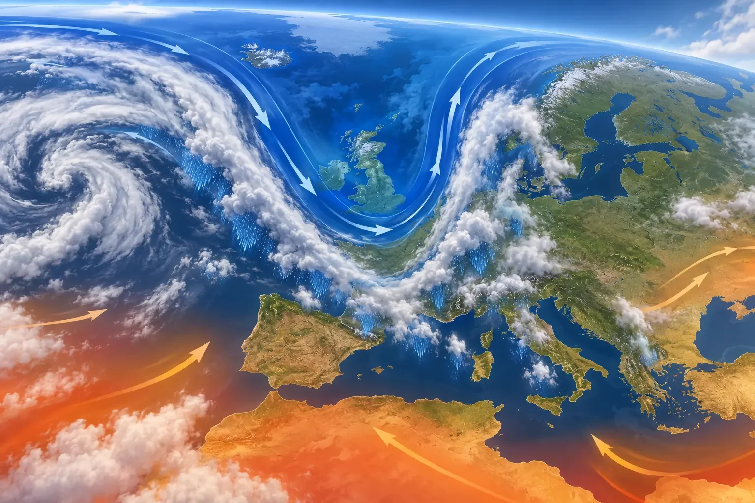
This is an educational guide, not a current warning. An upper-air trough is an elongated southward dip of relatively cold air and lower geopotential heights. It is often linked to rising air, greater instability, cloud, showers or thunderstorms, but a trough alone does not guarantee heavy rain at any particular location.
What an upper-air trough is
The flow high in the atmosphere does not always travel in a straight west-to-east line. It forms waves. Ridges bend polewards and often encourage sinking air and quieter weather; troughs extend equatorwards and tend to make rising motion and changeable weather more likely.
On a 500 hPa chart, a trough often appears as U- or V-shaped geopotential-height contours dipping southwards, frequently with colder air aloft. It is not a physical trench or a visible front but a three-dimensional pattern in the atmospheric flow.
Surface charts can also mark a trough. The Met Office describes it as an elongated area of relatively low pressure and notes that the term can also refer to an upper-tropospheric disturbance. Both are associated with increasing cloud and a risk of precipitation.
Why showers and thunderstorms may develop
Cold air at mid-levels can increase the temperature contrast with warmer, moister air near the ground. If convergence, hills, daytime heating or a front forces that air upwards, it cools and water vapour can condense.
A trough can also reshape upper-level winds and produce areas that support ascent. When moisture, instability and lift overlap, cumulus may grow into cumulonimbus. Our guide to cumulonimbus clouds explains how these storms can bring intense rain, hail, lightning and damaging gusts.
Without enough moisture, a trough may pass with high cloud or only isolated showers. Conditions also vary across short distances because the result depends on the trough axis, wind, terrain, nearby seas and time of day.
A trough is not automatically a cut-off low
A trough remains connected to the main westerly flow. A cut-off low becomes detached and forms a closed circulation aloft. A trough can sharpen and eventually cut off, but many never do.
It is therefore misleading to label every heavy-rain episode a cut-off low. Rainfall depends on the complete atmospheric setup and moisture supply. Conversely, a cut-off low does not automatically produce widespread flooding.
Weather that may accompany a trough
- Scattered showers: locally heavy while nearby places remain much drier.
- Thunderstorms: where moisture and instability are sufficient, with lightning, hail or gusts.
- Lower temperatures: especially when colder air is drawn in.
- A lower snow level: in the cold season if the temperature profile supports snow.
- Brighter intervals: a trough does not mean continuous rain.
How to identify one on a chart
- Use 500 hPa or geopotential-height charts as well as sea-level pressure.
- Look for contours bending equatorwards around colder air.
- Find the axis, but remember the most active weather may lie to one side where ascent is strongest.
- Combine upper-air charts with humidity, precipitation forecasts, radar, surface maps and warnings.
- Compare updates because position and speed can change.
Our guide to reading weather maps covers isobars, fronts, highs and lows. The Met Office chart guide also explains that surface troughs are drawn as black lines without the triangles or semicircles used for fronts.
How to use the information safely
“Trough” is not a warning level. Check the local forecast, timing, rainfall probability and totals, and above all official warnings. In Spain use AEMET; elsewhere in Europe, reach national services through Meteoalarm.
A Met Office explanation published on 15 September 2026 summarises the pattern: troughs generally support rising air, cloud, showers and rain, while ridges favour sinking air and calmer, drier intervals. The term explains the dynamics; observed conditions and official warnings define the actual risk.