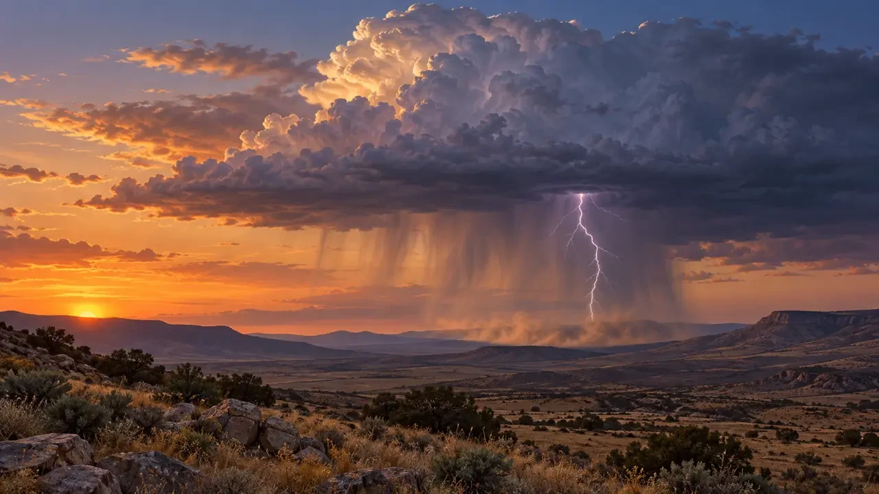
Seeing lightning beneath a thundercloud while feeling almost no rain may seem contradictory. It happens when precipitation falling from the cloud passes through a sufficiently dry layer and evaporates before reaching the surface. This is commonly called a dry thunderstorm. “Dry” describes conditions near the ground: the cloud still contains water and ice, separates electrical charge and can produce dangerous lightning.
This article is educational and does not replace current warnings. During any storm, consult your national weather service and local civil-protection advice.
What is a dry thunderstorm?
The US National Weather Service glossary describes it as a generally high-based thunderstorm in which lightning is observed but little, if any, precipitation reaches the ground. Most of the rain evaporates in the relatively dry air beneath the cloud.
It does not mean that no precipitation exists inside the cloud, or that every location remains completely dry. A shower may reach the ground in one place while nearby areas receive only a few drops. Brief rain or small hail can still occur.
How it forms: a high cloud base, dry air and virga
Thunderstorms require moisture, instability and lift. If the lower atmosphere is very dry, the cloud base can be high. Falling drops and ice particles then travel farther through unsaturated air. When they evaporate or sublimate before reaching the surface, they form virga: visible precipitation streaks that fade below the cloud.
Evaporation absorbs heat and cools the surrounding air. The cooler, denser air may accelerate downward and spread out at the ground, so a storm that produces little surface rain can still create a strong gust front. A concentrated downdraft is called a microburst. Not every dry thunderstorm produces one, and the terms are not interchangeable.
Main hazards
- Lightning: a strike can reach the ground outside the visible rain shaft. Staying dry does not mean you are safe.
- Sudden outflow winds: evaporation-enhanced downdrafts can cause abrupt wind shifts, blowing dust, falling branches and difficult driving conditions.
- Wildfire ignition: where vegetation is very dry, lightning may ignite a fire beyond the limited rain area. Actual risk depends on fuel moisture, wind and local conditions.
- Reduced visibility: dust raised by the outflow can quickly obscure a road.
Not the same as heat lightning, virga or a dry microburst
“Heat lightning” is usually ordinary lightning from a distant storm whose thunder can no longer be heard; it is not a separate type of lightning. Virga is precipitation that evaporates before reaching the ground and can occur without lightning. A dry microburst is a localized downdraft with little surface precipitation. It may accompany a dry thunderstorm, but it describes a wind event rather than the whole storm.
How to identify the pattern carefully
A high cloud base, streaks of virga and a dust plume below the storm are useful clues, but a photograph or a single observation cannot confirm the diagnosis. Weather radar may detect precipitation aloft while a nearby rain gauge records very little. Meteorologists combine radar, lightning, wind, humidity and rainfall observations.
What to do when lightning or gusts approach
- If you hear thunder, move into a substantial building or an enclosed hard-topped vehicle.
- Leave open ground, exposed ridges, isolated trees, wire fences and water.
- Indoors, avoid running water and equipment connected by cables while the storm is nearby.
- If blowing dust reduces road visibility, slow down progressively and follow traffic or emergency instructions.
- If you see smoke or fire, keep away and report its precise location to emergency services.
Do not read “dry thunderstorm” as a guarantee of zero rain. Always follow official thunderstorm, wind and fire-weather warnings.