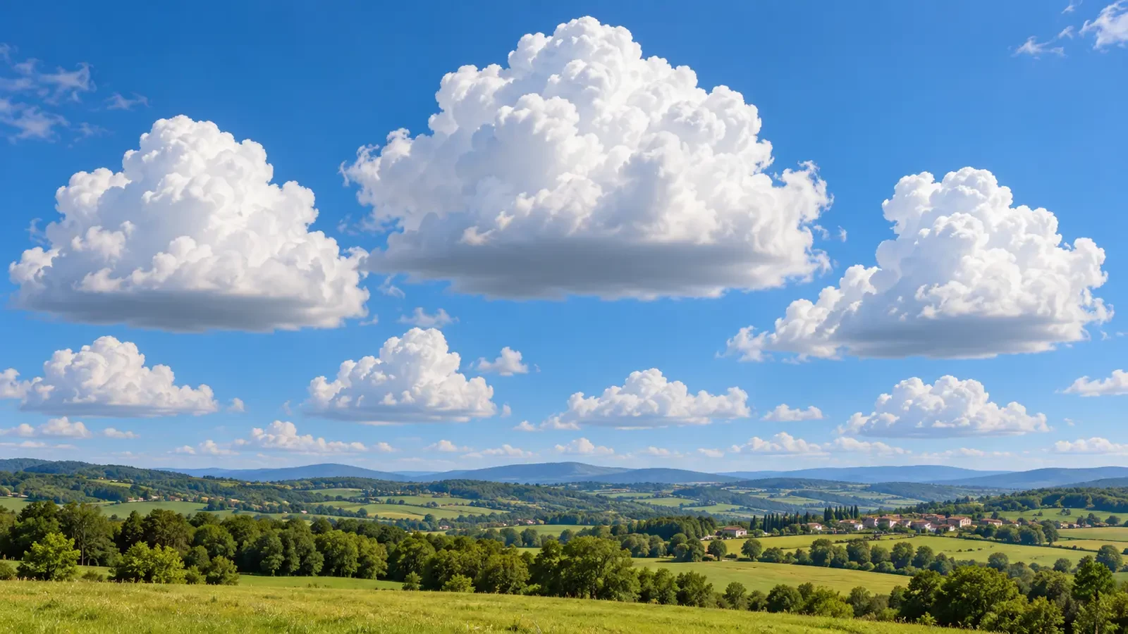
Cumulus clouds billow upwards like cauliflower, yet many share a striking feature: a dark, almost level base. It is not a solid platform or a layer cutting through the cloud. The line usually marks the height at which many rising bubbles of air reach, at roughly the same time, the conditions needed for water vapour to condense.
Rising air expands and cools
On a sunny day, patches of ground warm the air above them. If that air becomes less dense than its surroundings, it can rise as a thermal. Pressure decreases with height, so the rising air expands and cools. Much of this cooling is adiabatic: it happens because of expansion rather than direct heat loss to the surrounding air.
At first, the water vapour remains invisible. Cooler air, however, reaches saturation with less water vapour than warmer air. Once the rising parcel cools to its dew point, relative humidity reaches about 100%. Further lifting allows some vapour to condense on tiny airborne particles, producing visible cloud droplets.
A shared condensation level makes a level base
Thermals rising from a broad area within the same air mass often start with similar temperatures and moisture content. They therefore tend to reach saturation at similar heights. The lifting condensation level provides an estimate of the base of a cumulus cloud: below it, the air is unsaturated and transparent; just above it, condensation makes the lower edge visible.
Seen from a distance, droplets appear around a comparable altitude and trace an apparently horizontal line. NOAA describes the generally flat base of cumulus clouds as occurring where moisture in rising air condenses. The base is never perfectly mathematical: turbulence, terrain and local humidity differences create bumps and gaps.
Why does the underside look grey?
A cloud base may look grey even when its sunlit edges are bright white. A thick cloud scatters and weakens sunlight before it reaches the underside, while an observer on the ground sees the less illuminated face. A dark base alone does not guarantee rain, although greater vertical depth can accompany a more developed cloud.
Humidity changes the height
When near-surface air is humid, air temperature and dew point are close together. Only limited cooling is required before saturation, so the cloud base can be low. In drier air, a parcel must rise farther and cool for longer; the base is generally higher. Cumulus-base height can therefore offer a visual clue about moisture in the lower atmosphere, but it is not a substitute for an observation or sounding.
A useful qualitative rule is that a smaller surface temperature–dew-point spread usually corresponds to a lower condensation level. It remains an approximation because vertical mixing, moisture changes with height and elevated terrain all affect the actual cloud base.
Not every cloud has a perfectly flat base
This explanation works best for convective cumulus growing from a fairly uniform boundary layer. Near mountains, coasts and weather fronts, air can be lifted in different ways and may contain sharp moisture contrasts. Falling precipitation that partly evaporates can create ragged fragments beneath a cloud. Thunderstorm updraughts and downdraughts can distort the base and produce local features that should never be judged by shape alone.
Layer clouds can also have uniform-looking bases, but their formation is not necessarily driven by separate surface thermals in the way fair-weather cumulus is.
What can you infer by looking?
- A low base often means the air reaches saturation quickly, commonly because the lower layer is moist or the temperature and dew point are close.
- A high base often points to a drier layer below, although terrain elevation and the full atmospheric profile matter.
- Rapidly growing towers indicate active convection; check the forecast and warnings if development continues.
- A ragged or uneven base may reflect mixing, terrain, evaporating precipitation or competing air currents.
The key idea
A flat cloud base is essentially a visible phase boundary. Moist air rises and cools until it becomes saturated; above a similar height, vapour begins turning into droplets. The cloud appears to rest on a line, but that line is really where the atmosphere changes from invisible to visible.