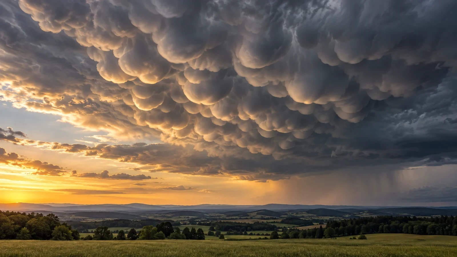
Mammatus appear as rounded pouches or lobes hanging from the underside of a cloud. They can look threatening, especially when low evening light outlines every bulge. Yet their presence does not mean that a tornado is about to form or that the storm directly overhead will necessarily be severe.
Mammatus is not a cloud genus
In formal classification, mamma is a supplementary feature: it describes a shape attached to a cloud rather than an independent cloud family. The WMO International Cloud Atlas defines it as hanging, udder-like protuberances and records it with cirrus, cirrocumulus, altocumulus, altostratus, stratocumulus and cumulonimbus.
It is therefore more accurate to describe a cumulonimbus with mamma than a stand-alone “mammatus cloud”. The feature is best known beneath the broad upper part of thunderstorms, particularly the anvil, but it is not limited to them.
How the pouches form
The anvil of a mature convective cloud can contain cold air, ice crystals and droplets. Some pockets become denser than the surrounding air and sink below the cloud base. Evaporation or sublimation of cloud particles can cool this descending air further, while mixing with the environment changes its humidity and buoyancy.
The visible result is not simply a bubble falling out of the cloud. It is a pattern of sinking motion, turbulence and mixing that sculpts a field of lobes. Their size, sharpness and lifetime depend on humidity below the cloud, stability, wind and the amount and type of particles. Well-defined pouches may last for minutes and then fade quickly.
Why sunset makes them spectacular
With the Sun high, a dark cloud base may offer little contrast. Near sunrise or sunset, sideways light catches the rims and undersides of the lobes. Many dramatic photographs owe much to that geometry: the illumination reveals a structure already present; it does not mean that the cloud has suddenly become more dangerous.
Do they signal severe weather?
Mammatus can show that a cloud has undergone strong vertical development and energetic processes aloft. When they occur beneath a cumulonimbus anvil, an active thunderstorm may be nearby or moving away. The shape alone, however, does not give the storm track, surface intensity or the exact risk at the observer’s location.
Nor are mammatus a specific tornado sign. Many non-tornadic storms produce them, and many tornadoes occur without visible mammatus. Risk assessment requires official warnings, radar, lightning information and the storm’s evolution, together with attention to thunder, gusts and rapid changes.
Can rain fall from the pouches?
The lobes are not bags waiting to burst. Depending on temperature and cloud type they may contain supercooled droplets, liquid water or ice, but the visible form is dynamic. Meaningful precipitation belongs to the wider cloud system and may fall far from the mammatus display.
How to observe them safely
- Look beneath an anvil or in cloud layers behind a storm, especially in side lighting.
- Do not remain in an open area to take photographs if thunder is audible; lightning can strike well away from rain.
- Never use their presence or absence as proof that a storm is safe.
- Check official local warnings and use a substantial building for thunderstorm shelter.
The useful interpretation
Mammatus are evidence of sinking and mixing processes beneath a cloud, not a complete forecast. They help us recognise sky structure. They can accompany intense storms and deserve caution when lightning is present, but they cannot diagnose a tornado or measure severity on their own.