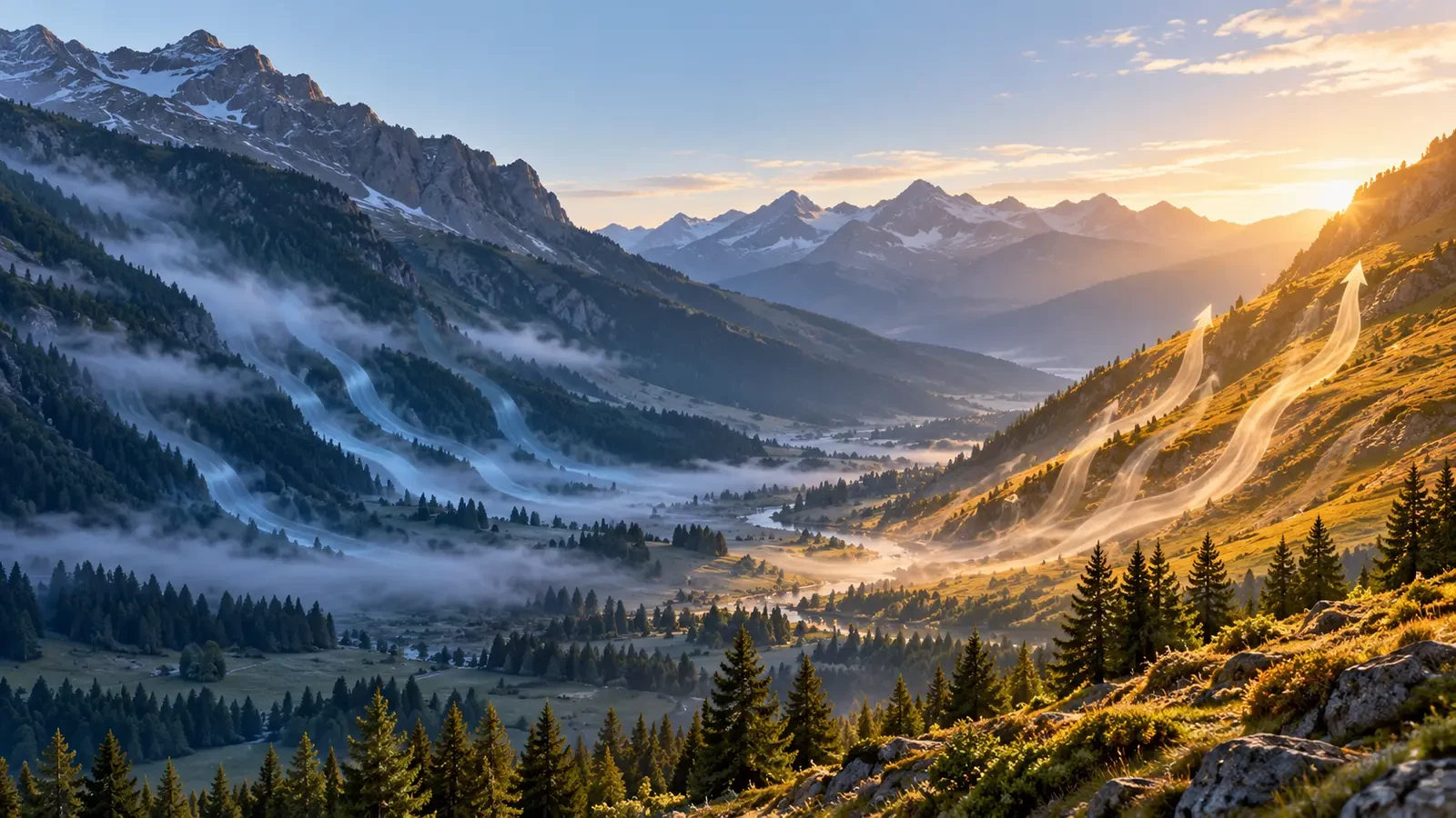
Wind can change direction inside a mountain valley even when the wider weather pattern seems steady. By day, air often moves up slopes heated by sunshine; at night, colder and denser air tends to drain towards the valley floor. These are the anabatic and katabatic components of local mountain circulation.
The cycle helps explain clouds, temperatures, smoke and local wind shifts, but it is not a clock. Slope aspect, cloud, snow cover, valley geometry and the regional wind can strengthen, delay or suppress it.
What is an anabatic wind?
After sunrise, a sun-facing slope can warm faster than the free air at the same altitude. Air touching the ground warms, becomes less dense and begins to flow uphill. This thermally driven upslope current is an anabatic wind.
It develops most clearly under strong sunshine and a weak background wind. Different aspects respond at different times: an east-facing slope may activate in the morning, while a west-facing slope peaks later. The slope flow may also feed a wind moving up the main valley towards higher ground.
What is a katabatic wind?
After sunset, the ground loses heat. Air touching a cold slope cools, becomes denser and moves downhill under gravity. This drainage collects in gullies and depressions and can pool on the valley floor, encouraging temperature inversions, frost, fog and lower minimum temperatures than on the middle slopes.
Ordinary nocturnal drainage is often light or moderate. Snow- and ice-covered terrain, however, may keep the air cold enough for downslope flow during daylight too. “Katabatic” describes dense air descending; it does not automatically mean a violent wind.
The usual daily sequence
- Dawn: cold drainage may still be reaching the valley floor.
- Late morning: sunny slopes begin to support upslope flow.
- Afternoon: anabatic and up-valley winds are often best developed.
- After sunset: heating stops, the flow weakens and may reverse downhill.
The transitions are gradual. Opposite slopes can reverse at different times, leaving a period of variable or calm wind before the new circulation becomes established.
When the pattern does not apply
A strong synoptic wind associated with large pressure systems can overwhelm the thermal circulation. Cloud reduces daytime heating and limits night-time cooling. Wet ground, vegetation, snow and slope angle also change how quickly the surface warms and cools.
Terrain adds further complexity. Passes, canyons and narrow valleys channel or accelerate the wind, while joining valleys can create turns and turbulence. Strong lee winds caused by mountain waves or a foehn setup are not the same as simple night-time drainage, even though both may blow downslope.
Clues in the landscape
Leaves, light dust and smoke can reveal near-surface direction, but smoke trapped beneath an inversion may not represent the wind on a ridge. Small cumulus clouds forming over sunny slopes suggest rising air and sufficient moisture, although clear skies do not prove that anabatic flow is absent.
Compare stations at different elevations, look at both valley and summit wind, and follow the trend rather than one observation. Coarse weather models may not resolve the circulation in a specific gully.
Implications for mountain activities
For hikers and cyclists, a wind reversal can alter wind chill and transport fog or smoke. For paragliding and light aviation, thermals, convergence and terrain turbulence require specialist interpretation; a local-wind rule never replaces aviation forecasts or a qualified pilot’s assessment.
During wildfires, the change from daytime upslope flow to night-time drainage can redirect smoke and fire behaviour. Emergency-service instructions always take priority over a general pattern. In farming, cold-air pooling explains why a low field may frost before another plot slightly higher on the slope.
Using the pattern safely
Before setting out, check the mountain forecast, official warnings and nearby observations. Note which slopes receive sun, whether cloud or snow is present, how strong the background wind is and when you expect to cross exposed passes.
Anabatic and katabatic winds are one part of local weather, not a complete forecast. Understanding them improves situational awareness, but complex terrain still demands continuous observation and current warnings.