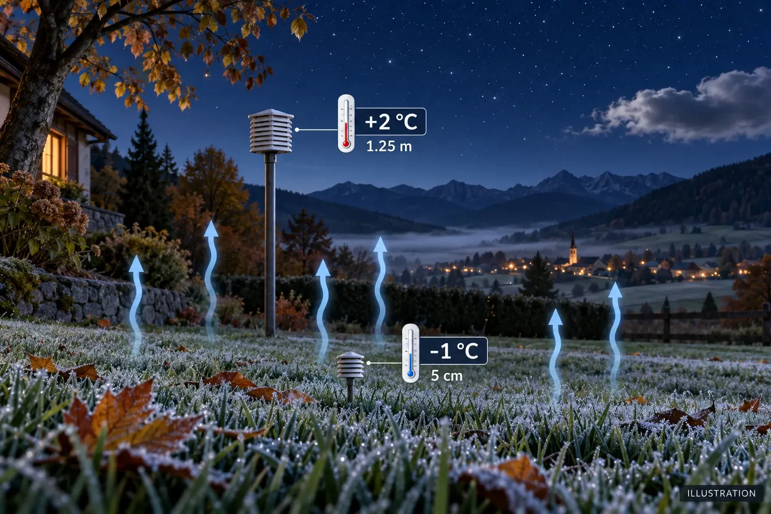
You wake to find ice on the grass and windscreen, even though the app reports a minimum of 2°C. There is no contradiction: the forecast air temperature and the temperature of an exposed surface are different measurements. On a clear, calm night, the ground can cool below 0°C while air at the standard meteorological measuring height remains above freezing.
Air frost and ground frost
An air frost occurs when temperature measured under standard meteorological conditions falls below 0°C. The thermometer is shielded from direct radiation and positioned roughly 1.25 to 2 metres above the ground, depending on the observing network.
A ground or grass frost occurs when temperature very close to the surface reaches 0°C or lower. The Met Office describes it using the grass minimum, while MeteoSwiss observes near-ground temperature at about 5 centimetres. An official low of +2°C can therefore coexist with -1°C among the grass blades.
A forecast temperature usually represents air at about 2 metres and summarises a model grid cell, not every garden, terrace or hollow. It should not be read as the minimum temperature of every exposed object.
Why the surface cools first
After sunset, the land surface loses energy by emitting infrared radiation. With clear skies, more of that energy can escape upwards. Grass, roofs, cars and leaves may cool faster than the air above them.
Air touching those surfaces also cools. Because cold air is denser, it tends to collect in low-lying places. This can create a very cold layer at ground level and a temperature inversion, with slightly milder air only a short distance above.
Conditions that favour frost
- Clear skies: allow stronger radiative heat loss from the ground.
- Light wind: limits mixing with milder air higher up.
- Relatively dry air: often supports stronger overnight cooling, although enough water vapour is needed for visible crystals to form.
- Long nights: give the surface more time to lose heat.
- Valleys and hollows: collect cold air draining downslope.
Clouds partly act like a radiative blanket, returning some energy towards the surface. Wind mixes the near-surface layer with air above. A cloudy, windy night can therefore remain frost-free in the same broad air mass that would produce ice under calm, clear conditions.
Hoar frost, frozen dew and rime are not the same
Hoar frost forms when water vapour deposits as ice crystals on a sufficiently cold surface. Frozen dew occurs when liquid dew forms first and subsequently freezes. Rime develops when supercooled fog droplets strike cold objects and freeze, often in wind, building a denser ice deposit.
Cold damage can also occur without a visible white coating. The absence of frost crystals does not prove that plants or surfaces stayed above a damaging temperature.
Why nearby places record different lows
Night-time microclimates can vary within a few metres. A mid-slope location may sit above a pool of cold air while the valley floor freezes. A wall releases heat stored during the day; open grass cools quickly; a town centre retains more warmth than its outskirts; the sea moderates temperature swings; and dense vegetation changes energy exchange.
Soil moisture, surface material and obstacles that block cold-air drainage also matter. A reading from an airport or official station cannot reproduce exactly what happens in a plant pot or on a rural road.
How to interpret a frost forecast
- Check the predicted minimum and timing, but also overnight cloud and wind.
- See whether the notice refers to air frost, ground frost or an agricultural frost risk.
- Consider the terrain: valley bottoms, hollows and rural areas are often more exposed.
- Compare several nights and learn your microclimate with a properly placed sensor.
- Follow warnings from the national meteorological service when a significant risk is expected.
The coldest point often occurs near dawn after many hours of heat loss, although arriving cloud or wind can alter the sequence. A positive temperature at sunset does not rule out the surface crossing 0°C before morning.
Practical precautions without overstating the forecast
For gardening, protect tender plants before the expected cold night and, where possible, keep covers from pressing directly on foliage. Move vulnerable pots to shelter and follow local agricultural advice. On the road, remember that bridges, shaded sections and rural routes can cool differently; if ice is present, slow down and avoid abrupt steering or braking.
A home thermometer is useful when placed away from walls, engines, direct sun and other heat sources. To compare with the forecast, measure air temperature separately and, if the garden matters, add a near-grass sensor.
Meteorological sources
- Met Office: frost and ice explained.
- Met Office: measuring air and grass minimum temperature.
- MeteoSwiss: ground frost.
- MeteoSwiss: definition of a frost day.
The key is to compare equivalent measurements. A forecast of +2°C at air-measuring height does not promise that every surface will remain above zero. On clear, calm nights, the ground can freeze before the official air temperature does.