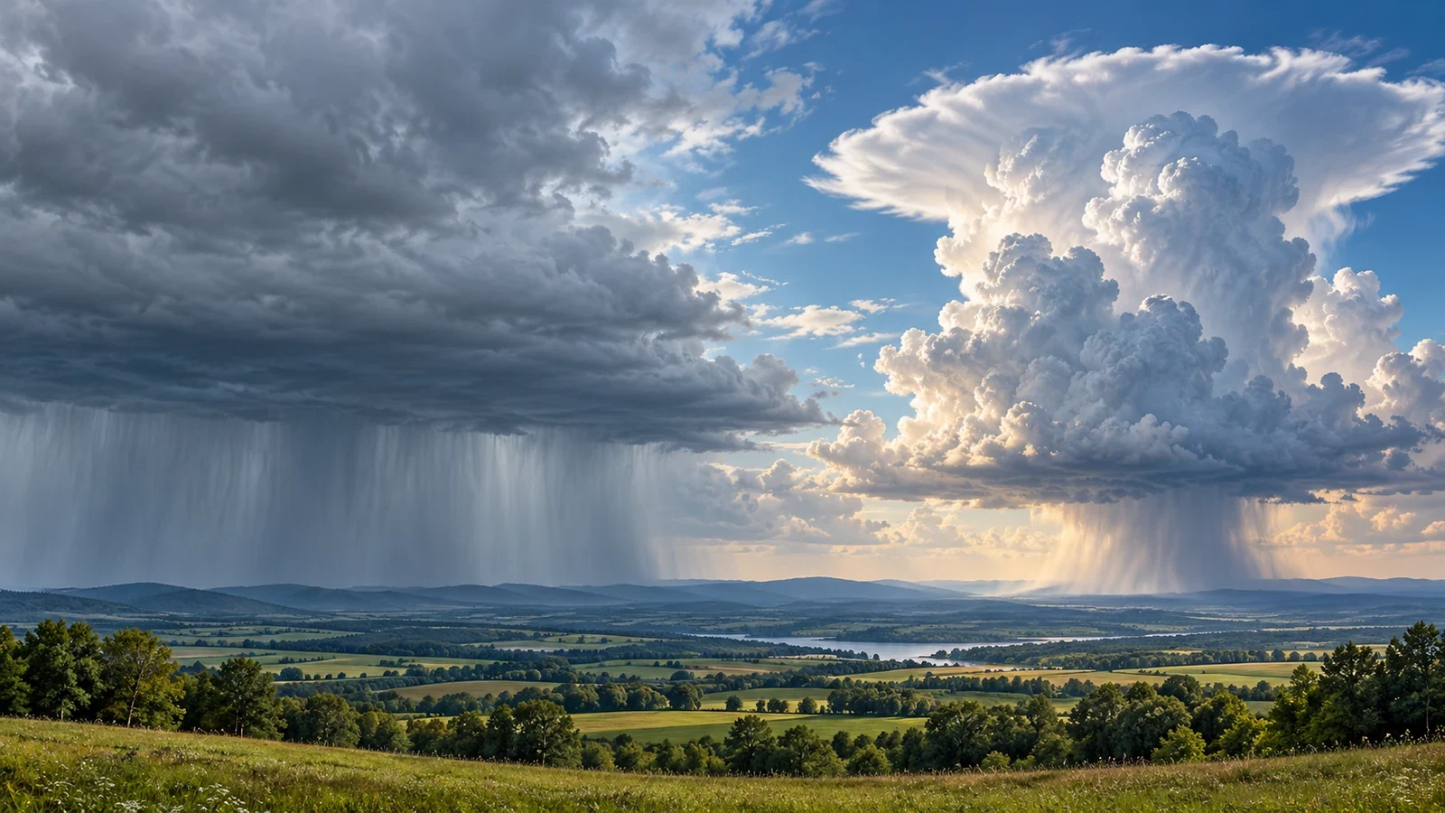
Not every dark cloud produces the same sort of rain. A grey sheet covering the sky may bring several hours of moderate precipitation, while a tall cloud can release a sharp downpour within minutes. The contrast often comes down to two cloud genera: nimbostratus and cumulonimbus.
The key distinction: a broad layer or a vertical tower
Nimbostratus is an extensive, thick, layered cloud. It commonly covers most of the sky, hides the Sun and has a diffuse base, especially when falling precipitation reduces visibility. It can look like a continuous grey ceiling with few clear edges.
Cumulonimbus develops vertically. It may begin as a growing cumulus and build into large towers; at maturity, its top can spread into an anvil. Its structure may be obvious from a distance, although beneath the storm the dark base and rain curtains can hide it.
What precipitation should you expect?
- Nimbostratus: widespread, fairly uniform and persistent rain or snow. Intensity can vary, but it usually changes less abruptly.
- Cumulonimbus: localised showers that can be intense and change quickly. Hail, lightning, thunder and strong gusts are possible.
“Continuous” does not always mean light, and “shower” does not automatically mean severe. The terms mainly describe character: sustained and widespread in the first case; intermittent, concentrated and variable in the second.
How to tell when the whole sky looks dark
Watch the sequence, not just a single view. A uniform layer, rain over a broad area and slow visual change point towards stratiform cloud. Growing towers, cauliflower-shaped edges, an anvil, sharply defined rain shafts or nearby bright gaps suggest convection.
One practical rule is particularly reliable: lightning, thunder or hail means cumulonimbus is present. Cumulonimbus can also be embedded within a much larger cloud mass, so an apparently steady wet day may still contain short-lived thunderstorms.
Why the distinction matters for plans
With nimbostratus, duration is often the main issue: waterproof clothing, poorer visibility, gradually saturated ground and long journeys in rain. With cumulonimbus, rapid change matters more: a dry location can move into a downpour, hail or squally wind quickly, while a nearby town remains much less affected.
Use these visual clues alongside radar, forecasts and official warnings. The sky helps explain current conditions, but cloud shape alone cannot give the future rainfall total or an exact storm track.
Safety around convective clouds
If you hear thunder, move into a substantial building or a fully enclosed vehicle; do not wait for rain to begin. Leave exposed ground, isolated trees, watercourses and flood-prone spots. Never drive through water covering a road. Persistent rain also deserves attention: several hours of moderate rainfall can create hazards without any lightning.
Quick summary
Grey layer with widespread, long-lasting rain: think nimbostratus. Vertical tower with localised showers, lightning or hail: think cumulonimbus. The most useful assessment combines cloud form, its evolution, radar and official warnings.