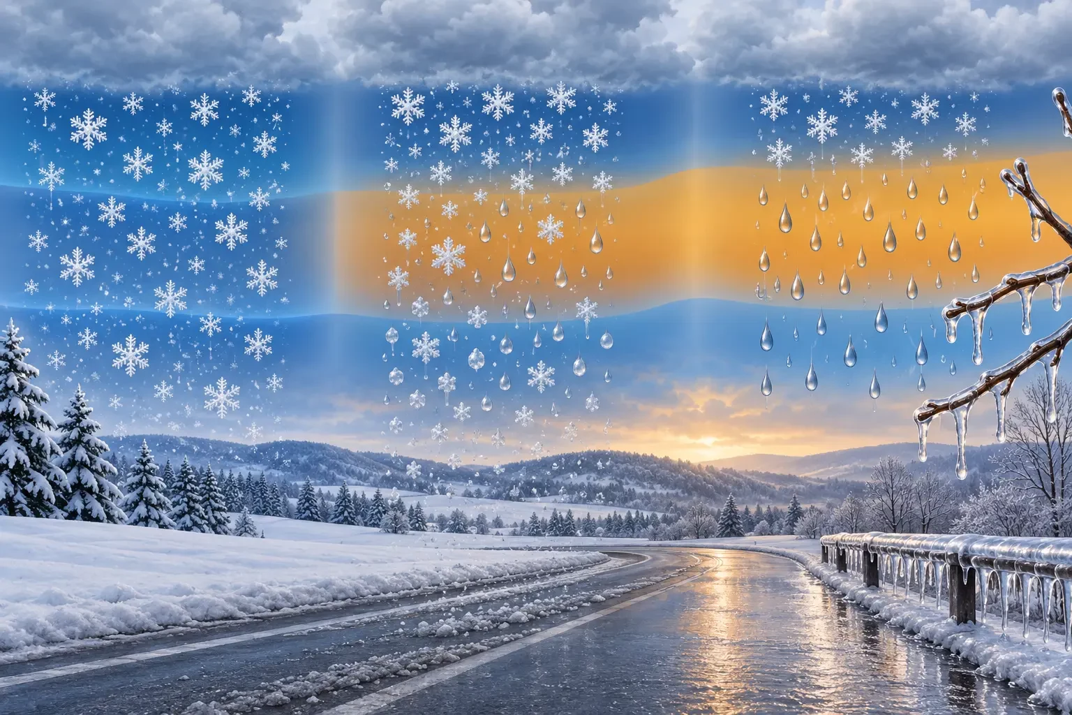
A winter forecast may mention snow, mixed rain and snow, or freezing rain even when surface temperatures look almost identical. The difference is not decided by one thermometer. It depends on the entire path from cloud to ground and on the depth of each warm or cold layer.
Understanding that profile makes forecasts easier to read and explains why ordinary-looking rain can create a particularly hazardous coating of ice. This is an educational guide, not a current warning. Always check the latest notices from the national weather service and road authorities before travelling.
The key idea: precipitation crosses several air layers
In a cold cloud, precipitation often begins as ice crystals. As they fall, those crystals encounter layers at different temperatures. If the column remains cold enough, they reach the ground as snow. A warm layer can melt them partly or completely; the outcome then depends on the temperature and depth of the lowest layer.
- Snow: flakes retain their frozen structure to the surface.
- Mixed rain and snow or wet snow: flakes partly melt, or drops and flakes fall together.
- Freezing rain: snow melts in a warm layer, then the drops enter a shallow subfreezing layer. They remain liquid but supercooled and freeze on contact with a surface below 0 °C.
If the lower cold layer is deep enough, drops may refreeze before reaching the ground and become ice pellets. That is not freezing rain: freezing-rain drops arrive at the surface as liquid.
Why freezing rain can be deceptive
Freezing rain can look like ordinary rain while it is falling. The hazard develops as drops freeze on roads, pavements, steps, branches and power lines, producing transparent glaze ice. At night, it may be almost indistinguishable from a wet surface.
Only a thin coating is needed to reduce grip. Ice can also linger on bridges, shaded sections and exposed surfaces when nearby roads look clear. Our guide to frost when the air temperature is above freezing explains why a surface may freeze even when a standard thermometer reads above 0 °C.
“Sleet” is an ambiguous word
Forecast language varies by country. In the United Kingdom, sleet often means rain and snow falling together; in North America it commonly means ice pellets. “Wintry mix” can cover several combinations. Read the forecast description rather than relying on one icon: does it describe wet flakes, pellets that bounce, or liquid drops that freeze on contact?
Snow level and freezing level are not identical
The freezing level is the altitude where the free-air temperature is around 0 °C. The snow level estimates where precipitation will fall mainly as snow. The two need not match because humidity, precipitation intensity, terrain, evaporation and melting affect how far flakes survive below the freezing level.
A forecast snow level does not guarantee settling. The ground may be too warm, precipitation may be light, or flakes may melt on contact. Conversely, a surface chilled during previous hours can ice over while the air measured slightly above it is positive.
How to read a winter forecast
- Identify the exact place and time. A regional forecast cannot describe every valley, pass or street.
- Read the precipitation wording. Do not infer “rain only” from a generic symbol.
- Check levels and hourly changes. A small thermal shift can change the precipitation type.
- Consider the surface and recent temperatures. Road conditions depend on the preceding hours too.
- Prioritise official warnings. An educational map or automated forecast never replaces an active alert.
Practical precautions when ice is possible
- Avoid non-essential travel when authorities warn of freezing rain or widespread ice.
- If already driving, slow down smoothly, leave a much larger gap and avoid sudden braking or steering. Stop somewhere safe if conditions deteriorate.
- Treat dark, glossy road surfaces with suspicion: transparent ice can resemble water.
- Keep away from ice-loaded branches and fallen power lines.
- Check the newest weather and traffic information before departure and during long journeys.
Official sources and current warnings
The explanation follows the AEMET descriptive guide to weather phenomena hosted in its Arcimis repository. For travel in Spain, AEMET MeteoRuta provides road-oriented weather information. Current forecasts and warnings are available from the official AEMET website; elsewhere, use the competent national weather service and civil-protection authority.