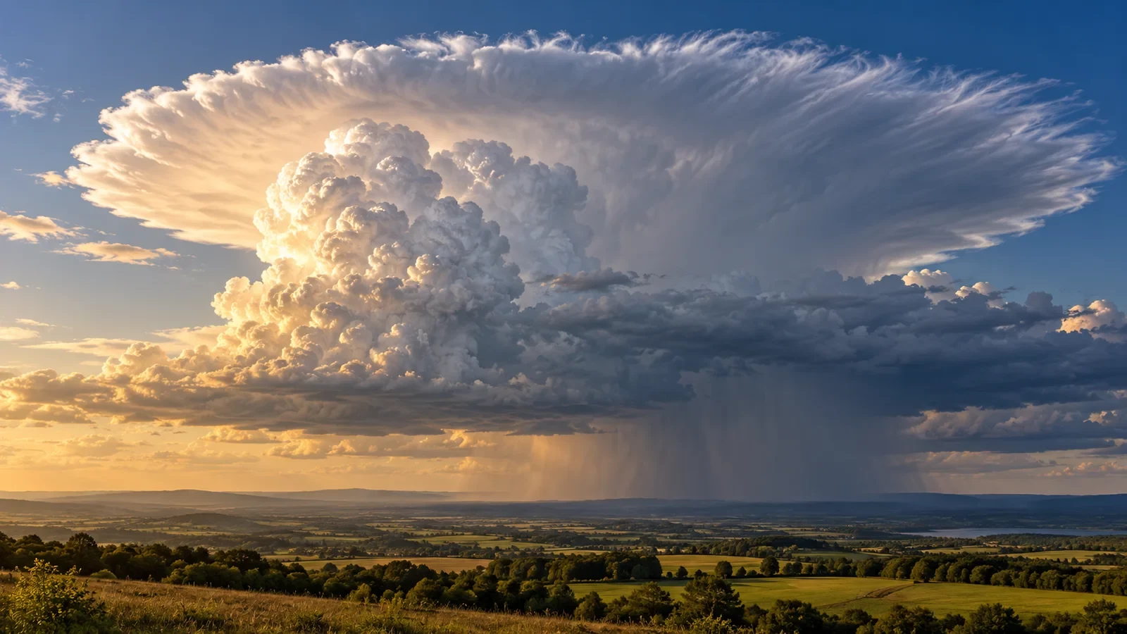
When a thundercloud grows into a huge tower and its top spreads horizontally, we are looking at the anvil of a cumulonimbus. Its technical name is incus. It is a clear visual sign that convection has reached the upper troposphere, but the anvil alone does not prove that the storm is severe.
Why vertical growth stops
Warm, humid air rises in the storm’s updraught. As it climbs it cools, water vapour condenses and, at sufficiently cold levels, much of the cloud becomes ice crystals. Near the tropopause the atmosphere becomes much more stable and resists further ascent. Cloud material spreads sideways and upper-level winds stretch it into an anvil.
The World Meteorological Organization defines incus as the upper part of a cumulonimbus spread into an anvil shape, with a smooth, fibrous or striated appearance. The fibrous texture reflects its ice-rich composition.
What a developed anvil tells us
A broad anvil indicates a mature cumulonimbus and an updraught capable of carrying moisture to great height. Its plume also shows the prevailing flow aloft, usually spreading downwind. This does not guarantee that the entire storm will travel that way: new cells may grow on another flank and alter the apparent motion.
The dome above the anvil
A rounded bulge sometimes rises above the flattened surface. This overshooting top forms when a powerful updraught briefly penetrates the stable layer before sinking back. A persistent dome is evidence of vigorous convection and raises concern for hail, strong wind or intense rain, but confirmation requires radar, satellite, lightning data and official warnings.
Lightning beyond the rain
An anvil can extend many kilometres beyond the rain shaft. Electrical charge also occupies this icy region, allowing lightning to reach places with little rain or even patches of blue sky. A distant-looking dark core does not make an outdoor location safe.
- If thunder is audible, move into a substantial building or hard-topped vehicle.
- Do not shelter under an isolated tree, open canopy or beach umbrella.
- Leave hilltops, beaches, open fields and water.
- Wait until the storm is clearly gone before resuming the activity.
Anvil precipitation and virga
Dense rain or hail shafts often sit beneath the convective core. Ice crystals may fall from the anvil edges and evaporate before reaching the surface, creating virga. Conditions below can look quiet while lightning and sudden outflow winds remain possible.
What shape cannot prove
An anvil does not by itself confirm a supercell, tornado or giant hail. Nor can the eye judge distance reliably because the cloud is enormous. A greenish tint, very dark base or dramatic form may be striking, but hazard assessment must rely on radar, lightning detection and weather warnings.
Observing safely
From shelter, look for the cauliflower-like tower, its transition to a fibrous top and the direction in which the anvil spreads. Then check radar and official alerts. Visual observation explains the storm’s structure; it should never be used as a reason to approach it or replace official information.