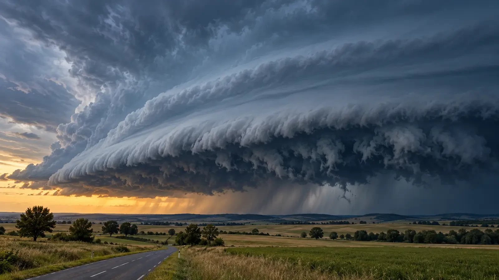
A low, dark band stretches across the horizon ahead of a thunderstorm. Its leading edge resembles a wedge, while the underside looks ragged and turbulent. The sight can be intimidating, but it does not mean that a tornado is approaching. It is more likely an arcus cloud, commonly called a shelf cloud.
The WMO International Cloud Atlas describes arcus as a dense horizontal roll on the lower front part of certain clouds. It occurs with Cumulonimbus and, less often, Cumulus.
How a shelf cloud forms
Rain-cooled air descends from a storm and spreads out when it reaches the ground. This cold outflow pushes beneath the warmer, more humid air ahead of it and forces that air upward. Cooling during the ascent causes condensation, creating a cloud band along the gust front.
The outer edge may look smooth and sharply defined, while ragged fragments churn underneath. The feature remains attached to the parent storm. A sudden wind shift, falling temperature, heavy rain, hail or lightning may follow, but appearance alone cannot reveal the exact strength of the coming gusts.
Shelf cloud, roll cloud and tornado
- Shelf cloud: a wedge-shaped cloud attached to the parent cloud, usually marking a thunderstorm outflow boundary.
- Roll cloud: a detached horizontal tube that may appear to rotate around its axis.
- Tornado: a violently rotating column of air connecting a convective cloud to the ground. Turbulence beneath an arcus is not enough to identify one.
Low scraps of cloud beneath the storm can also be mistaken for a funnel. Confirming a tornado requires organised rotation and ground contact; a single dramatic photograph rarely establishes either.
What its arrival tells you
An arcus is visible evidence that the gust front is near. The most immediate hazard is often a rapid increase in wind, which can lift unsecured items, break branches and make driving difficult. On coasts and inland waters, the abrupt change can endanger swimmers, paddleboarders and small craft. Lightning may occur before rain reaches your position.
Not every arcus is damaging, and cloud shape does not provide a severity rating. Official warnings, radar and local observations are needed to assess the situation. Visual recognition adds context but never replaces the forecast.
What to do
- Stop outdoor activity and move into a substantial building or enclosed vehicle.
- Keep away from trees, temporary structures and loose objects.
- Leave beaches, pools, boats and other exposed water locations.
- Secure awnings and furniture only if there is time before the gust arrives.
- Do not drive towards the storm or stop in an exposed place for photographs.
- Follow the official weather service and wait until the lightning threat has passed.
A useful clue, not a complete forecast
Recognising an arcus helps you understand that thunderstorm outflow is reaching the area. Its spectacular structure does not prove that a tornado will form and cannot quantify wind speed. The sensible response is to seek shelter early, follow official warnings and watch only from a safe location.