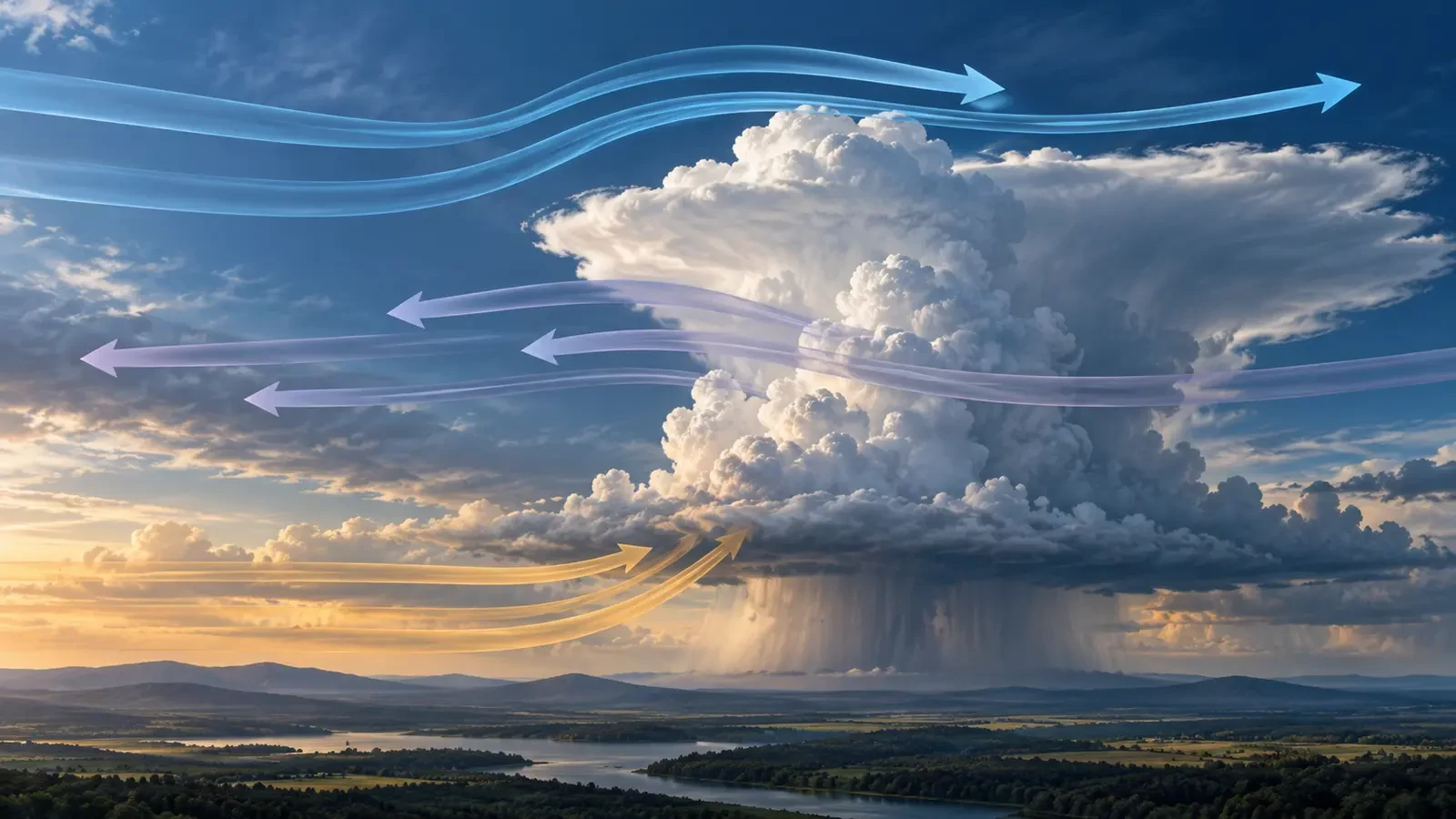
Wind does not necessarily blow the same way throughout the atmosphere. It may be light near the ground and much stronger several kilometres above, or turn from southerly to westerly with height. A change in speed, direction or both is called wind shear.
Shear is crucial for understanding storm structure, but two misconceptions are common: that shear always produces severe weather, and that strong winds aloft equal the gusts expected at the surface. Neither is true on its own.
What wind shear measures
The National Weather Service glossary defines shear as the rate at which wind velocity changes between points. It can involve speed, direction or both.
- Vertical shear compares wind at different heights.
- Horizontal shear describes changes across distance at roughly the same level, often near boundaries.
- Speed shear occurs when wind accelerates or weakens without much turning.
- Directional shear occurs when wind turns from one level to another.
The result depends on the layer selected. Saying that shear is “strong” without naming the depth, such as surface to 6 km, omits essential context.
Why it matters to thunderstorms
Thunderstorms need moisture, instability and lift. Shear replaces none of these ingredients and does not create storms by itself. It can, however, change how an existing updraught is organised.
When wind varies with height, the updraught may tilt. This can separate rising air from precipitation and downdraughts, reducing interference between them. Where the wider environment is favourable, cells may last longer and organise into multicells, lines or supercells.
Directional shear can also supply rotation to the flow. A storm may tilt and stretch some of that rotation, but wind shear does not automatically mean a tornado. Other parameters and expert analysis are required.
Strong shear does not always mean a strong storm
Marked shear can exist in dry or stable air with no deep convection. Conversely, intense storms can develop in weak-shear environments when instability is large. Such storms are often less organised and shorter-lived, yet may still produce torrential rain, hail or damaging local gusts.
Forecasters therefore assess shear together with moisture, temperature, instability, forcing and storm motion. One number is never a complete diagnosis.
How it is observed and forecast
- Weather balloons build vertical profiles of wind, temperature and humidity.
- Numerical models estimate wind on multiple pressure levels and calculate layer changes.
- Doppler radar measures motion associated with precipitation and can help identify intense velocity changes or rotation.
- Stations and aircraft reports add observations near the surface and along flight routes.
The Aviation Weather Center provides specialist operational products because low-level shear and turbulence matter greatly to aviation.
Reading shear on maps and apps
A 10-metre wind map shows only near-surface flow. To infer vertical shear, compare several heights or pressure levels, such as the surface, 850, 700 and 500 hPa. Pressure levels do not correspond to one fixed altitude in every situation.
Ask how much speed changes and how far direction turns. Always check the legend because colours, units and arrow conventions differ among apps.
Do not translate a strong 500 hPa wind directly into an equal surface gust forecast. Vertical mixing, stability, terrain, fronts and downdraughts determine how much momentum reaches the ground.
Not the same as a gust, gust front or downburst
A gust is a brief increase at one location. A gust front is the leading edge of cool thunderstorm outflow. A downburst is descending air spreading out at the surface. Each can create abrupt local shear, but the terms are not interchangeable.
What it means for the public
Shear helps explain why two apparently similar thunderstorm days can evolve differently. It is not a stand-alone public risk index. Use official warnings, radar evolution and civil-protection guidance for decisions. This article explains a general concept, not a current warning.
Technical sources: National Weather Service glossary and the Aviation Weather Center.