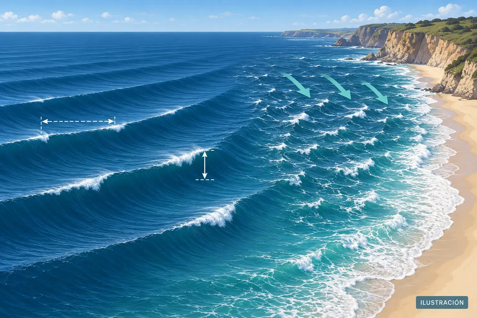
A forecast of “1-metre waves” sounds simple, but it does not mean every wave will be exactly one metre or that every beach will receive the same conditions. A useful marine assessment combines height, period, direction, wind, swell, tide and warnings.
This guide explains common marine-forecast fields. It does not replace an official coastal bulletin, lifeguard instructions or the planning required for navigation.
Significant wave height: a statistic, not the maximum
The height displayed by many forecasts is significant wave height: approximately the average height of the highest third of waves over a period. It is used partly because it resembles the height an experienced observer perceives, but any sea state contains both smaller and larger waves.
A significant height of 1 metre is therefore not a 1-metre ceiling. The Met Office notes that, over a sufficiently long exposure, individual waves up to around twice the significant height may be encountered. They do not arrive regularly and the statistic cannot predict a particular wave; it simply means the displayed value is not a maximum.
Period: the time between crests
Wave period is given in seconds. It describes the time between successive crests; many products show the peak period, associated with the most energetic wave group. Two seas with the same significant height can behave very differently:
- A short period usually means closely spaced waves, often irregular and generated by nearby wind.
- A longer period often indicates organised swell that has travelled from a distant generating area.
For the same height, longer-period waves can carry more energy and break more forcefully or run farther up some shores. There is no universally “safe” period, however: beach shape, depth and the intended activity all alter the risk.
Wind sea and swell
Wind sea is generated by wind acting on the water locally or nearby. As wind increases it is often shorter, steeper and more irregular. Swell has propagated beyond its generating area; it can arrive under light local winds and from a different direction.
Total sea combines these components. If an app gives only one figure, check whether it offers separate layers for total waves, wind waves and swell. Two systems arriving from different directions can create a confused sea even if neither looks exceptional on its own.
Direction: coming from or travelling towards?
Arrow conventions differ between services. Some report the direction waves come from; others draw the direction of travel. Always check the product legend. Then compare the wave path with the orientation of the coast: headlands, islands and bays can shelter a beach or focus energy through refraction.
An offshore wave height does not transfer unchanged to the shoreline. As waves enter shallower water, their speed, direction and height change before breaking. Local bathymetry, sand bars, reefs and beach slope matter greatly.
Wind, gusts, tide and sea level
Local wind can build waves, roughen the surface quickly and make the return of small craft difficult. Examine mean wind and gusts separately; our guide to mean wind and gusts explains the distinction.
Tide is a separate variable. High tide coinciding with waves, onshore wind or a meteorological rise in sea level can increase wave run-up and the risk of overtopping or coastal flooding. Wave heights and tide heights use different reference levels, so they should not simply be added without an appropriate model.
Practical checklist before a coastal activity
- Check the official bulletin and warnings for the exact area as well as a general app.
- Read the update time and forecast interval; an old screenshot can hide changes.
- Assess significant height, period and direction, not just an icon.
- Separate wind sea and swell where the product allows it.
- Review mean wind, gusts, visibility, thunderstorms and tide.
- Consider coastal exposure, depth, currents and safe exit routes.
- Obey flags, closures, lifeguards and harbour authorities. Postpone if conditions exceed your experience or equipment.
Common mistakes
- Treating significant height as the largest possible wave.
- Deciding from height alone while ignoring a long period.
- Confusing swell with local wind.
- Assuming a sheltered beach remains sheltered after wave direction changes.
- Using an offshore value as an exact measure of surf at the shore.
- Checking tide without waves and coastal warnings, or vice versa.
In summary
A marine forecast works as a set. Significant height is a statistical description, period indicates wave spacing and helps reveal energy, and direction shows how waves may approach the coast. Wind, swell, tide and local geography complete the picture.