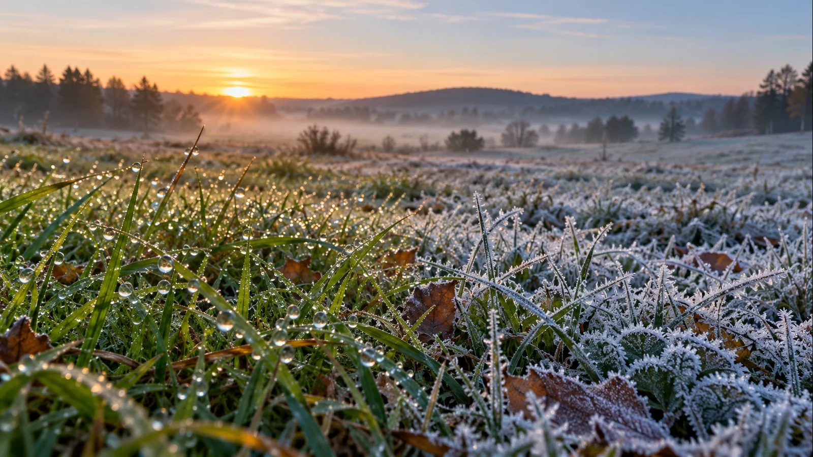
A cold morning may leave droplets on grass, white crystals on a car or an almost invisible film on the pavement. They are often grouped together as “frost”, but they do not form in the same way and do not carry the same risk. Telling dew, hoar frost, frozen dew and clear ice apart helps explain what happened overnight and highlights slippery surfaces before you walk or drive.
Dew: liquid water on a cooled surface
Dew forms when a surface—grass, metal, glass or a leaf—cools until the air touching it reaches its dew point. Some water vapour then condenses into small liquid droplets. The air temperature measured at the standard height does not need to fall below 0°C.
It is common after clear, light-wind nights. The ground and exposed objects lose heat by radiation. Cloud and a moderate breeze usually limit that cooling by returning radiation towards the surface or mixing the lowest layers of air.
Hoar frost: ice crystals rather than white droplets
Hoar frost is recognised by white crystals that may resemble needles or feathers. It develops when the surface is below freezing and water vapour is deposited as ice. The reported air temperature may still be slightly above 0°C because grass, a car roof or a bridge can become several degrees colder than the air.
A forecast minimum of 2°C therefore does not rule out local frost. Hollows, valleys, sheltered gardens and bridges are particularly exposed: cold air collects in low spots, while elevated structures lose heat from both their upper and lower surfaces.
Frozen dew and clear ice
Not every white deposit started as hoar frost. If liquid dew forms first and the surface later drops below freezing, the droplets may freeze. This is frozen dew, which tends to preserve rounded droplet shapes rather than the branching crystal structure of hoar frost.
Clear ice can form when liquid water—from rain, fog, meltwater or condensation—freezes into a smooth layer. On a road it can be hard to see and far more dangerous than obvious white frost. Shaded areas, bridges, flyovers and places where water drains across the surface may freeze first or remain icy after sunrise.
Reading the clues in the morning
- Droplets that roll or wet your hand: probably liquid dew.
- White, feathery crystals: hoar frost.
- Rigid beads or frozen droplets: possibly frozen dew.
- A smooth, nearly transparent sheen: possible ice; treat it as slippery.
Appearance is a clue, not a guarantee. A dry patch can sit beside an icy one because of small differences in shade, material, exposure to the sky or drainage.
Why the thermometer does not tell the whole story
Forecasts and weather stations report air temperature under standard conditions. Surface temperature also depends on material, orientation and how efficiently it loses heat. A car roof, metal walkway or lawn can reach freezing while the air is slightly warmer. Dew point matters too: in very dry air, little moisture may be deposited even when surfaces become cold.
What to do on a potentially icy morning
Check the forecast minimum, but also cloud cover, wind and humidity. After a clear, calm and cold night, allow time to de-ice the windscreen. Do not pour hot water onto glass: thermal shock can damage it and the runoff may refreeze. Take short steps on suspect surfaces and slow down before bridges, shaded bends and damp stretches of road.
Sunshine often removes dew quickly, but it does not thaw every icy patch at once. Ice can linger in shade or on cold materials. A useful rule is: if a surface shines when temperatures are near freezing, do not assume it is merely wet.
In brief
Dew is liquid; hoar frost consists of ice crystals; frozen dew began as droplets; and clear ice can result from water freezing on a surface. Texture, temperature, shade and the source of moisture help distinguish them—and help you anticipate slipping hazards.